Find volunteer work by town, ZIP code and driving distance
A collapsed section of the filter panel takes the town you start from and how far you will go, then drops everything outside that ring.
Distance is a section of the opportunity filters that takes a town or a Clinton County ZIP code plus a radius in miles, keeps the listings inside that ring, and puts the nearest ones at the top. Miles are counted from the middle of your town to the middle of the listing's town, so it sorts the county into near and far rather than giving you a drive time. Listings whose organization never set a town have nothing to measure from and drop out while a radius is on.
Who this is for: Anyone without a car, on a short lunch break, or unwilling to drive the length of Route 120 on a school night.
- 1
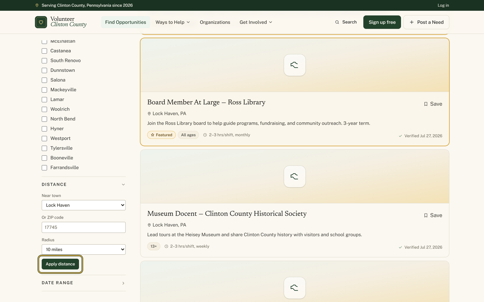
Open the opportunities page and find the "Filters" panel down the left side; on a phone, tap "Filters" to open it first.
- 2
Click the row marked "Distance". It sits collapsed until you do, which is why most people never find it.
- 3
Choose where you are starting from under "Near town", the menu that begins on "Choose a town", or type five digits into "Or ZIP code" instead.
- 4
Set how far you are willing to travel under "Radius", which offers 5, 10, 15, 25, 40 and 75 miles and starts on "10 miles".
- 5
Press "Apply distance". The nearest listings move to the top and badges appear above them reading "Near: Lock Haven" and "Within 10 miles".
- 6
Widen the radius when the ring comes back too tight, or press "Apply distance" with "Near town" back on "Choose a town" and the ZIP box empty to drop the ring on its own. "Clear all" beside the badges works too, but it clears every other filter with it.
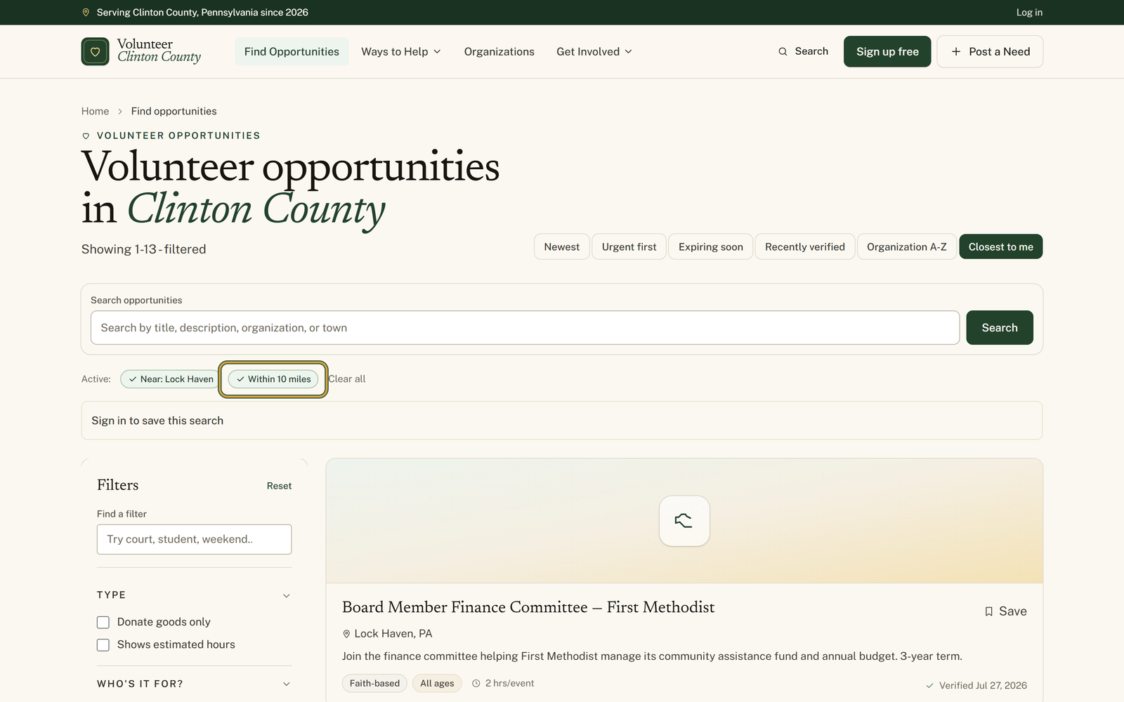
You'll know it worked when: The nearest listings first, under a row of badges naming the town or ZIP you picked and the number of miles.
Watch out for: Both ends of the measurement are town centres, and the listing's end comes from the town its organization chose. A listing posted without a town has no point on the map, so a radius search leaves it out no matter how close it really is.
What this doesn't do: Not a map and not a route. You get no street address and no drive time, and the "Closest to me" button above the results is a different thing: it asks your browser for your location rather than reading the town you picked. Pressing it also clears the ring you set.
The ZIP code. When both boxes have something in them the ZIP wins and the town is ignored, so clear the ZIP box if the town is the one you meant.
Nine Clinton County ZIPs are on the map the radius search reads from: 17721, 17726, 17745, 17748, 17750, 17751, 17764, 17778 and 17779. Anything else, including ZIPs just over the county line, has no point to measure from, so the page tells you so and shows every listing instead of a narrowed set. Pick the nearest town from the menu instead.
No. It is a straight line between the centre of your town and the centre of the listing's town, so a listing on the far side of a ridge can read closer than the drive feels. Treat it as which end of the county rather than as a route.
Its organization did not attach a town to it. Distance needs a town on both ends, so listings without one are left out of a radius search entirely. Clear the distance filter and it comes back.
That button asks your browser for your location and sorts by it, without any ring around the results. The Distance section works from a town you choose, and it hides what falls outside the miles you set. Pressing that button also clears the town, ZIP and radius you had set, so it replaces a distance search rather than adding to it. Use the Distance section when you are planning from your kitchen table for somewhere else.
Volunteer Clinton County is a community directory. You browse what local organizations post and contact them directly. More guides